

Sports

Diane Stamm | Johnson Publications
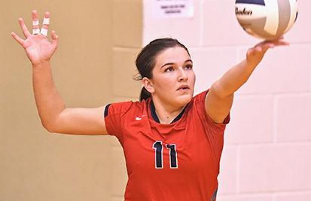
Payton Yearous finished her senior year with second on the team with 49 aces and tied for second with 116 kills.
It was a different volleyball season than many around Wauneta-Palisade expected, but the season was a good one.
By By Diane Stamm The Wauneta Breeze
Courtesy photo | Amberette Riener
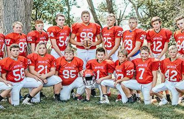
Members of the Wauneta-Palisade junior high football team are (front row, left to right) Luke Sims, Casey Walker, Draven Miner, Gregory Littrel, Andrew Mackety, Konner McCrumb, Kameron McCrumb, Konner Shifflet, Blake Nickerson, (back row, left to right) Felix Alfayo, Justin Warembourg, Tyler Baker, Collin Bley, Grayden Sutherland, Noah Sandman, Camden DeWester, Gabe McCrumb, Aden Acton, Ashton Wheeler and Michael Alfayo.
Wauneta-Palisade junior high teams wrapped up their seasons in October.

Diane Stamm | Johnson Publications
Peyton Cox (13) tips a ball back to Hitchcock County as Payton Yearous (11) backs her up during Wauneta-Palisade’s sweep of the Falcons in the second round of the RPAC tournament.
While the RPAC tournament didn’t finish the way the Wauneta-Palisade volleyball team would have hoped, the Broncos won the first round of subdistricts Monday against Medicine Valley and set up a re
By Diane Stamm
School
Among offices on this year’s November election ballot will be three seats on the Wauneta School Board.
By By Tom Pantera The Wauneta Breeze

Shelby Brennan | Johnson Publications
Homecoming royalty was crowned Thursday during the tailgate party in the Ag Shop. Royalty is Hector Caro, Anthony Sramek, King Braxton McKinney, Queen Payton Yearous, Haylee Sandman and Lillie Miner with crown bearers Milly West and Jase Cox.
Among offices on this year’s November election ballot will be three seats on the Wauneta School Board.
Wauneta Breeze
308-394-5389 (Phone)
324 N. Tecumseh
PO Box 337
Wauneta NE 69045